Datei:Locmap-hoodcanal-ss.png
Größe dieser Vorschau: 461 × 600 Pixel. Weitere Auflösungen: 184 × 240 Pixel | 369 × 480 Pixel | 802 × 1.043 Pixel.
Originaldatei (802 × 1.043 Pixel, Dateigröße: 103 KB, MIME-Typ: image/png)

|
Dieses Bild des Typs Locator map sollte als Vektorgrafik im SVG-Format neu erstellt werden. Vektorformate haben zahlreiche Vorteile; weitere Information unter Commons:Media for cleanup. Wenn dir eine SVG-Version dieses Bildes vorliegt, so lade diese bitte hoch. Nach dem Hochladen der Datei ist diese Vorlage auf der aktuellen Bildbeschreibungsseite durch die Vorlage {{Vector version available}}, oder kürzer {{Vva}}, zu ersetzen. Es ist empfohlen die neue SVG-Datei „Locmap-hoodcanal-ss.svg“ zu nennen – dann benötigt die Vorlage vector version available (bzw. vva) keinen Parameter.
|
Beschreibung
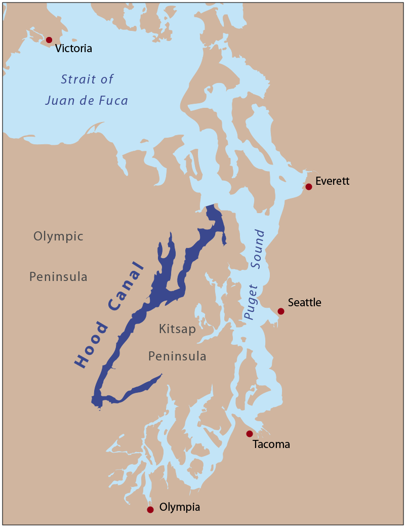
| Beschreibung | This is a locator map of Hood Canal. I, Pfly, made it with ArcGIS, Adobe Illustrator, and Adobe Photoshop. Used screenshot method to see how colors differ from direct save from Illustrator. |
| Datum | |
| Quelle | Eigenes Werk |
| Urheber | Pfly |
Lizenz
Ich, der Urheberrechtsinhaber dieses Werkes, veröffentliche es hiermit unter der folgenden Lizenz:

|
Es ist erlaubt, die Datei unter den Bedingungen der GNU-Lizenz für freie Dokumentation, Version 1.2 oder einer späteren Version, veröffentlicht von der Free Software Foundation, zu kopieren, zu verbreiten und/oder zu modifizieren; es gibt keine unveränderlichen Abschnitte, keinen vorderen und keinen hinteren Umschlagtext.
Der vollständige Text der Lizenz ist im Kapitel GNU-Lizenz für freie Dokumentation verfügbar. |
Diese Datei ist unter den Creative Commons-Lizenzen Namensnennung – Weitergabe unter gleichen Bedingungen 4.0 International, 3.0 nicht portiert, 2.5 Allgemein, 2.0 Allgemein und 1.0 Allgemein lizenziert.
- Dieses Werk darf von dir
- verbreitet werden – vervielfältigt, verbreitet und öffentlich zugänglich gemacht werden
- neu zusammengestellt werden – abgewandelt und bearbeitet werden
- Zu den folgenden Bedingungen:
- Namensnennung – Du musst angemessene Urheber- und Rechteangaben machen, einen Link zur Lizenz beifügen und angeben, ob Änderungen vorgenommen wurden. Diese Angaben dürfen in jeder angemessenen Art und Weise gemacht werden, allerdings nicht so, dass der Eindruck entsteht, der Lizenzgeber unterstütze gerade dich oder deine Nutzung besonders.
- Weitergabe unter gleichen Bedingungen – Wenn du das Material wiedermischst, transformierst oder darauf aufbaust, musst du deine Beiträge unter der gleichen oder einer kompatiblen Lizenz wie das Original verbreiten.
Du darfst es unter einer der obigen Lizenzen deiner Wahl verwenden.
Dateiversionen
Klicke auf einen Zeitpunkt, um diese Version zu laden.
| Version vom | Vorschaubild | Maße | Benutzer | Kommentar | |
|---|---|---|---|---|---|
| aktuell | 04:04, 22. Apr. 2008 | | 802 × 1.043 (103 KB) | wikimediacommons>Pfly | == Summary == {{Information |Description=This is a locator map of Hood Canal. I, Pfly, made it with ArcGIS, Adobe Illustrator, and Adobe Photoshop. Used |
Dateiverwendung
Die folgende Seite verwendet diese Datei: