Datei:Boone-06own-map.jpg
Größe dieser Vorschau: 470 × 600 Pixel. Weitere Auflösungen: 188 × 240 Pixel | 580 × 740 Pixel.
Originaldatei (580 × 740 Pixel, Dateigröße: 241 KB, MIME-Typ: image/jpeg)
Beschreibung
| Beschreibung |
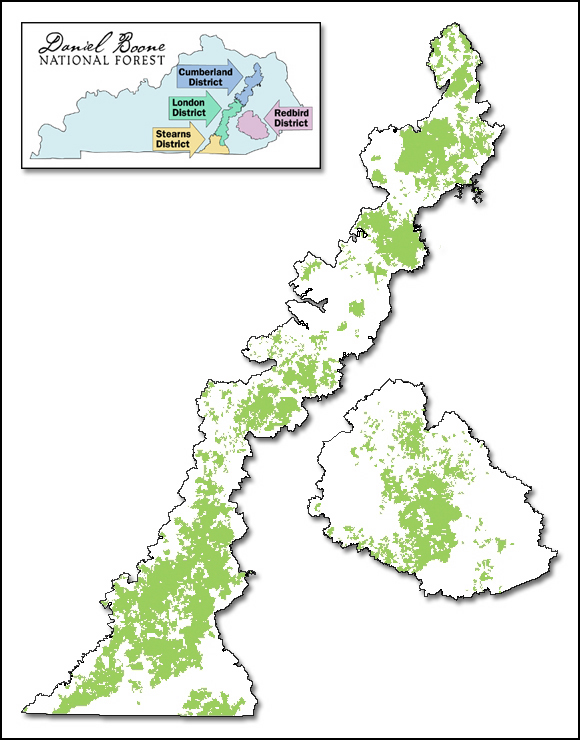
English: Map of Daniel Boone National Forest showing proclamation boundary and lands actually owned by the Forest Service, as of March 15, 2006. Inset map shows ranger districts. |
| Datum | |
| Quelle | http://www.fs.usda.gov/detail/dbnf/about-forest/?cid=stelprdb5277049 |
| Urheber | webpage cites Author as Lands Staff. |
| Genehmigung (Weiternutzung dieser Datei) |
http://www.fs.fed.us/privacy.shtml states: Information presented on this website is considered public information and may be distributed or copied unless otherwise indicated. Use of appropriate byline/photo/image credit is requested. |
Lizenz
This image is a work of the Forest Service of the United States Department of Agriculture. As a work of the U.S. federal government, the image is in the public domain.
|
Dateiversionen
Klicke auf einen Zeitpunkt, um diese Version zu laden.
| Version vom | Vorschaubild | Maße | Benutzer | Kommentar | |
|---|---|---|---|---|---|
| aktuell | 01:49, 21. Sep. 2006 | | 580 × 740 (241 KB) | wikimediacommons>Pfly | {{Information |Description=Map of Daniel Boone National Forest showing proclamation boundary and lands actually owned by the Forest Service, as of March 15, 2006. Inset map shows ranger districts. |Source=http://www.fs.fed.us/r8/boone/aboutus/ownership.s |
Dateiverwendung
Die folgende Seite verwendet diese Datei: